
The Carolina Core corridor, mapped.
Causey Aviation Service · Greensboro, NC · Reviewed September 2026
Winston-Salem to Fayetteville, with all four state-certified megasites marked. Causey Aviation drew this map for its own use and is making it available to anyone who needs one — reporters, economic development offices, site selectors, students. Republish it free of charge. Just credit Causey Aviation and link back.
Verified 15 September 2026 against nccarolinacore.com. Spotted something out of date? Tell us and it gets fixed.
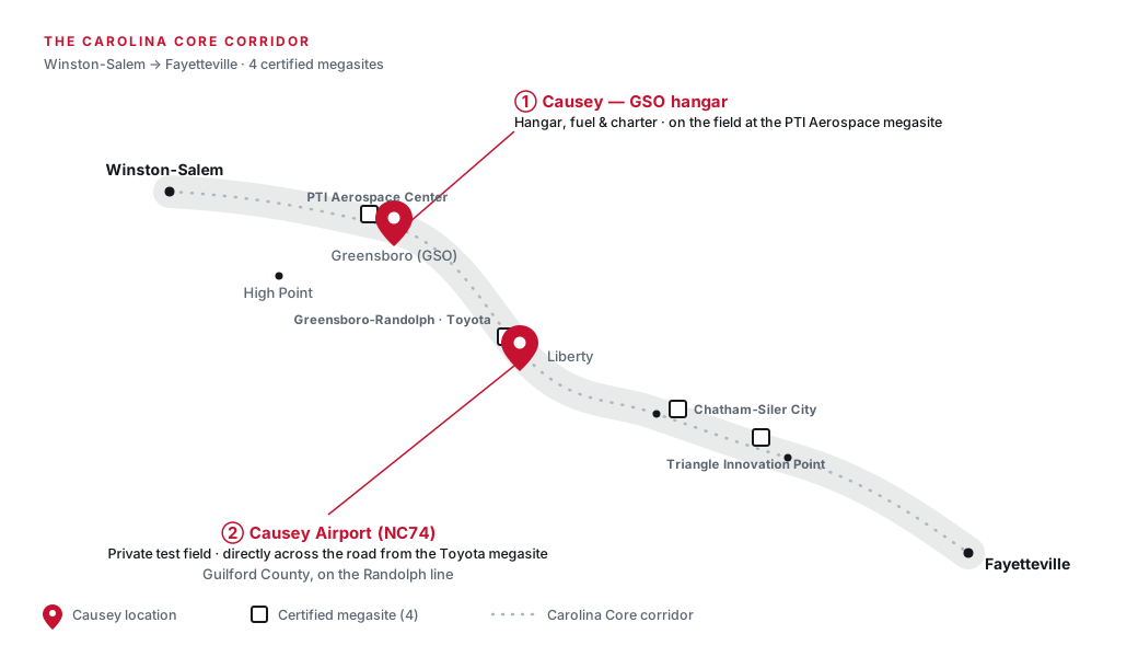
PNG is 2080 × 1200 px. SVG is vector — enlarge it to any size for print without losing quality.
You can use this. Here is the whole licence.
No permission request, no fee, no form to fill in. Editorial or commercial use, print or online.
- You may republish, resize, embed and print the map
- You must credit Causey Aviation, and online, link to causeyaviation.com
- Please do not alter the map so it states something Causey did not — moving markers, changing labels, or removing the “schematic, not to scale” caveat
Credit line — copy this
For print or anywhere a link is not possible:
Map: Causey Aviation
For online use:
Map: <a href="https://www.causeyaviation.com/carolina-core-map">Causey Aviation</a>
Embed the image
<figure> <img src="https://www.causeyaviation.com/images/carolina-core-corridor.png" alt="Map of the Carolina Core corridor from Winston-Salem to Fayetteville with four certified megasites" width="1040" height="600"> <figcaption>Map: <a href="https://www.causeyaviation.com/carolina-core-map">Causey Aviation</a></figcaption> </figure>
Hotlinking the image from our server is fine. So is hosting your own copy.
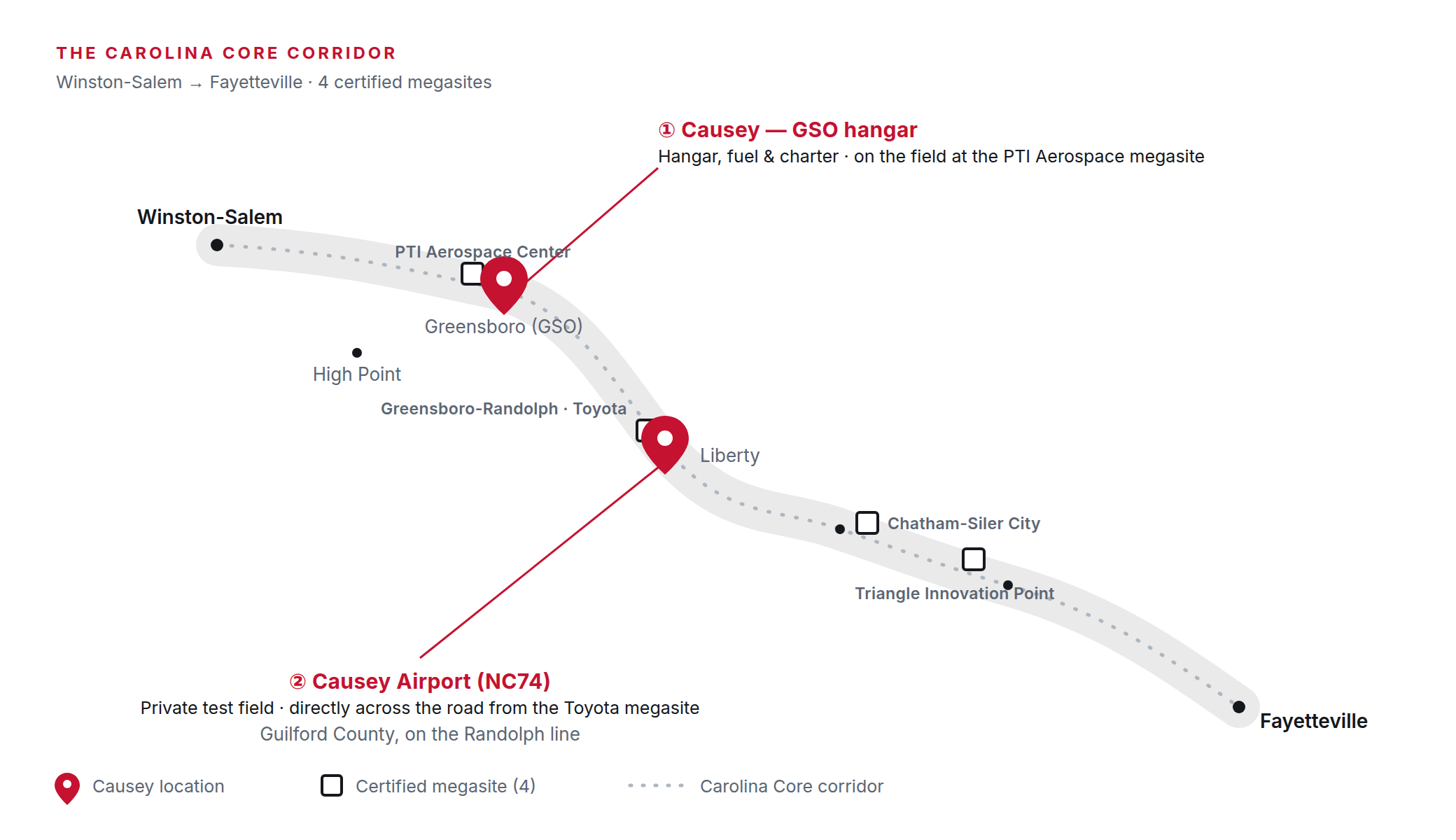
The corridor, the four megasites, and two Causey locations.
The Carolina Core is a roughly 150-mile corridor across central North Carolina, from Winston-Salem in the northwest to Fayetteville in the southeast. It holds four state-certified megasites — large, pre-assembled, infrastructure-ready industrial tracts:
- PTI Aerospace Center — on the field at Piedmont Triad International Airport, Greensboro
- Greensboro-Randolph — the site of Toyota’s battery plant
- Chatham · Siler City
- Triangle Innovation Point
The two red markers are Causey Aviation: the hangar, fuel and charter base on the field at Greensboro PTI, and Causey Airport (NC74), the family’s private airfield in Liberty, directly across the road from the Greensboro-Randolph megasite.
Can I republish the Carolina Core corridor map?
Yes, free of charge, for editorial or commercial use, in print or online. No permission request and no fee. Credit Causey Aviation, and online, link to causeyaviation.com. Hotlinking the image from our server is fine, and so is hosting your own copy. The one restriction: do not alter the map so it states something Causey did not — moving markers, changing labels, or removing the “schematic, not to scale” caveat.
What file formats is the map available in?
PNG and SVG, both downloadable from this page. The PNG is 2080 × 1200 px. The SVG is vector, so it enlarges to any size for print without losing quality.
Is the map to scale?
No. It is a schematic diagram, not a survey and not a navigational chart. Positions are illustrative and exist to show the relationship between the corridor, the megasites and the two Causey locations. Please keep that caveat with the map if you republish it, and do not use it for navigation or for any decision that needs accurate geography.
Writing about the Carolina Core? We are happy to talk.
(888) 866-8965 · [email protected]